Travel Guide of Mount Hawthorn WA in Australia by Influencers and Travelers
The City of Vincent is a local government area of Western Australia. It covers an area of approximately 10.4 square kilometres in metropolitan Perth, the capital of Western Australia, and lies about 3 km from the Perth CBD.
Download the Travel Map of Australia on Google Maps here
The Best Things to Do and Visit in Mount Hawthorn WA
TRAVELERS TOP 10 :
1 - Rottnest Island
Rottnest Island is an island off the coast of Western Australia, located 18 kilometres west of Fremantle. A sandy, low-lying island formed on a base of aeolianite limestone, Rottnest is an A-class reserve, the highest level of protection afforded to public land.
Learn more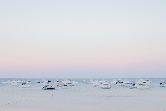
2 - Perth WA
Government House is the official residence of the Governor of Western Australia, situated in the central business district of Perth, the state capital. It was built between 1859 and 1864, in the Jacobean Revival style.
Learn more Book this experience
3 - Morning | Perth Aviation activities
Get ready for an adventure as you soar over the Rottnest Island, nestled in the vibrant heart of Western Australia. Brace yourself for a heart-pounding skydive from breathtaking heights of 10,000 ft, 14,000 ft, or 15,000 ft, all under the watchful eye of seasoned tandem instructors. The 20-minute scenic flight promises to leave you stunned as the island’s beautiful coastline unfolds beneath. As the parachute opens, enjoy a serene 5-minute canopy ride, gently touching down onto a pristine island beach. After landing, make sure to keep your camera handy, as the island's adorable resident quokkas are always camera-ready.
Book this experience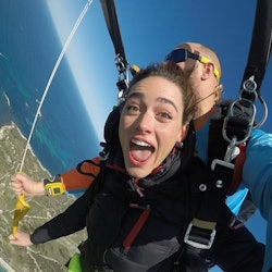
4 - Fremantle
Fremantle is a major Australian port city in Western Australia, located at the mouth of the Swan River in the Perth metropolitan area. Fremantle Harbour serves as the port of Perth, the state capital. Fremantle was the first area settled by the Swan River colonists in 1829. It was declared a city in 1929, and has a population of approximately 29,000.
Learn more Book this experience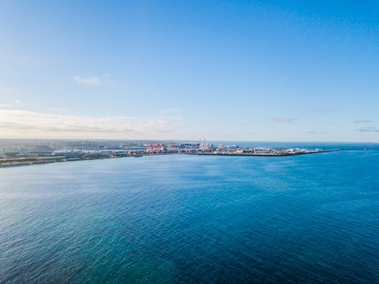
5 - Elizabeth Quay
Elizabeth Quay is a mixed-use development project in the Perth central business district. Located on the north shore of Perth Water and centred on the landmark Swan Bells, it was named in honour of Queen Elizabeth II during her Diamond Jubilee.
Learn more Book this experience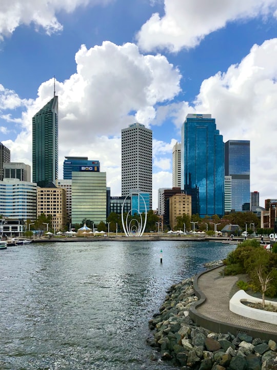

6 - Skydiving | Perth Aviation activities
Throw caution to the wind and let your spirit take flight over Rottnest Island, nestled like a hidden gem in the heart of Western Australia. Venture out on a 20-minute scenic flight that will take your breath away as the island and its stunning coastline unfold beneath. Then, get ready to take the leap of a lifetime as you skydive from dizzying altitudes of 10,000 feet, 14,000 feet, or even 15,000 feet, guided by experienced tandem instructors. As the parachute blooms overhead, enjoy a serene 5-minute canopy ride, gently touching down onto an unspoiled island beach. Your adventure continues on the ground, exploring the island's enchanting trails. Keep your camera ready because you never know when you'll bump into the island's adorable local Quokkas.
Book this experience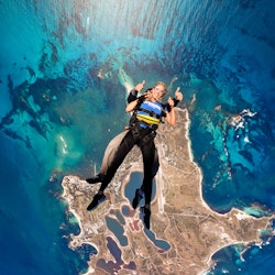
7 - Perth
Perth is the capital and largest city of the Australian state of Western Australia. It is named after the city of Perth, Scotland and is Australia's fourth-most populous city, with a population of 2.14 million living in Greater Perth.
View on Google Maps Book this experience
8 - Victoria Square
Victoria Square is the name of the area and road that runs around the edge of the grounds of St Mary's Cathedral in Perth, Western Australia. It is the northern extension of Victoria Avenue.
Learn more
9 - 1 Barrack Square
Barrack Square is an open public square on the foreshore of Perth Water on the Swan River, located at the southern end of Barrack Street near the central business district of Perth, Western Australia.
Learn more Book this experience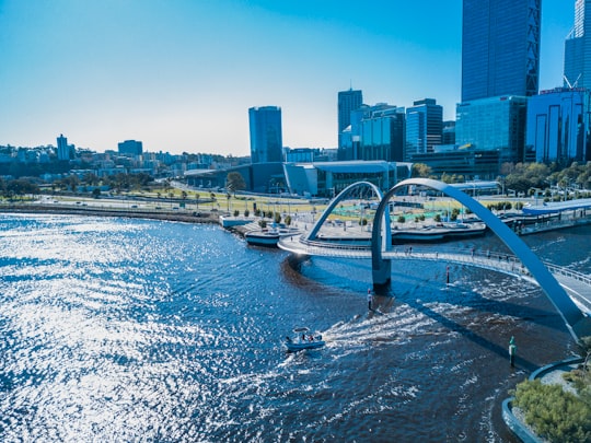
10 - Armadale
Armadale is a suburb of Perth within the City of Armadale, located on the south-eastern edge of the Perth metropolitan region. The major junction of the South Western and Albany Highways, which connect Perth with the South West and Great Southern regions of Western Australia respectively, is located within the suburb.
View on Google Maps Book this experience
11 - Quinns Rocks
Quinns Rocks is an outer coastal suburb of Perth, Western Australia, located 38 kilometres north of Perth's central business district. It is part of the City of Wanneroo local government area. The suburb was formerly established in 1962 as a rural townsite, focused around Quinns Beach, the area's main amenity.
Learn more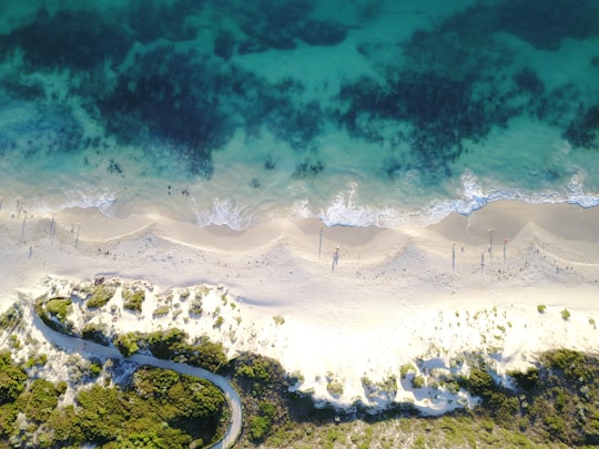
12 - Floreat Beach
Floreat Beach is in Western Australia, located off West Coast Highway, directly next to City Beach. The beach's southern extremity is a groyne and continues north past a drain pipe until Hale Road dog beach.
Learn more Book this experience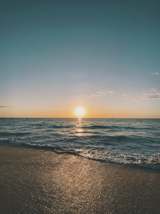

13 - City of Perth
The City of Perth is a local government area and body, within the Perth metropolitan area, which is the capital of Western Australia. The local government is commonly known as Perth City Council. The City covers the Perth city centre and surrounding suburbs. The City covers an area of 20.01 square kilometres and had an estimated population of 21,092 as at 30 June 2015. On 1 July 2016 the City expanded, absorbing 1,247 residents from the City of Subiaco.
View on Google Maps Book this experience
14 - East Perth
East Perth is an inner suburb of Perth, Western Australia, located next to the Perth central business district. Claise Brook and Claisebrook Cove are within the suburb.
View on Google Maps Book this experience
15 - The Esplanade
The Esplanade Reserve in Perth, Western Australia was a heritage listed public space between Perth Water and the Perth central business district.
View on Google Maps Book this experience
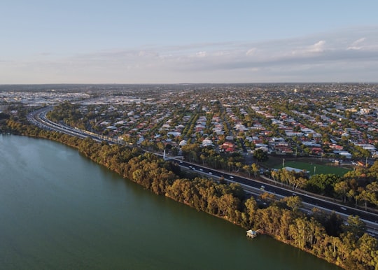
16 - Mount Hawthorn
Mount Hawthorn is a suburb of Perth, Western Australia, located within the City of Vincent. The Mount Hawthorn area was first selected for urban development in 1887.
View on Google Maps Book this experience
17 - Crawley
Crawley is a suburb of Perth, Western Australia, located within the City of Subiaco and City of Perth. The earlier name of the locality was Crawley Park. It was named by an early landowner Henry Charles Sutherland, whose mother's maiden name was Crawley. It is home to the University of Western Australia, the state's oldest university.
View on Google Maps Book this experience
18 - Canning River
The Canning River is a major tributary of the Swan River in the South West Land Division of Western Australia. It is home to much wildlife including dolphins, pelicans, swans and many other bird species.
View on Google Maps Book this experience
19 - Canning River Regional Park
The Canning River Regional Park is the largest of eight regional parks within the Perth metropolitan area. The park covers approximately 6 km on both sides of the Canning River between the bridges carrying Nicholson Road and Leach Highway over the Canning River.
View on Google Maps Book this experience
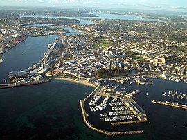
20 - Fremantle Harbour
Fremantle Harbour is Western Australia's largest and busiest general cargo port and an important historical site. The inner harbour handles a large volume of sea containers, vehicle imports and livestock exports, cruise shipping and naval visits, and operates 24 hours a day.
View on Google Maps Book this experience
21 - Swan Valley
The Swan Valley is a region in the upper reaches of the Swan River between Guildford and Bells Rapids, Western Australia. It is bordered to the east by the Darling Scarp.
View on Google Maps Book this experience
22 - Esplanade Park
Esplanade Park is a public reserve in Fremantle, Western Australia. Situated on Marine Terrace and opposite the Esplanade Hotel, the reserve features about 100 mature Norfolk Island pines and the Explorers' Monument.
View on Google Maps Book this experience
Disover the best Instagram Spots around Mount Hawthorn WA here
Book Tours and Activities in Mount Hawthorn WA
Discover the best tours and activities around Mount Hawthorn WA, Australia and book your travel experience today with our booking partners
Pictures and Stories of Mount Hawthorn WA from Influencers
Picture from David Broadway who have traveled to Mount Hawthorn WA
Plan your trip in Mount Hawthorn WA with AI 🤖 🗺
Roadtrips.ai is a AI powered trip planner that you can use to generate a customized trip itinerary for any destination in Australia in just one clickJust write your activities preferences, budget and number of days travelling and our artificial intelligence will do the rest for you
👉 Use the AI Trip Planner
Why should you visit Mount Hawthorn WA ?
Travel to Mount Hawthorn WA if you like:
🏞️ WaterwayLearn More about Mount Hawthorn WA
Mount Hawthorn is an emerging downtown with a rich history and a strong community that evolved from a satellite center at the north end of Perth in the late 1800's. It has a truly local feel, with leafy streets and a wide range of local businesses that serve the daily needs of the local population. A hidden gem.
Where to Stay in Mount Hawthorn WA
Discover the best hotels around Mount Hawthorn WA, Australia and book your stay today with our booking partner booking.com
More Travel spots to explore around Mount Hawthorn WA
Click on the pictures to learn more about the places and to get directions
Discover more travel spots to explore around Mount Hawthorn WA
🏞️ Waterway spotsTravel map of Mount Hawthorn WA
Explore popular touristic places around Mount Hawthorn WA
Download On Google Maps 🗺️📲